Air pollution moves following dominant wind movements, often guided by topogrpahical features. In the case of tropospheric ozone, since it is a photochemically-produced secondary pollutant, this means that the negative effects are often found quite some distance downwind of major pollution sources (i.e. inherently transboundary).

In the cases of California and Catalonia, both of which have severe summertime ozone pollution problems, the major wind trajectories push the air pollution from coastal population centers inland off of the Pacific and Mediterranean. This, along with deep valleys and other topographical features, results in high pollution levels in the interior at the sites of the protected mountain forests of Yosemite and Sequoia/Kings Canyon National Parks in California and the Cerdanya region of Catalonia.

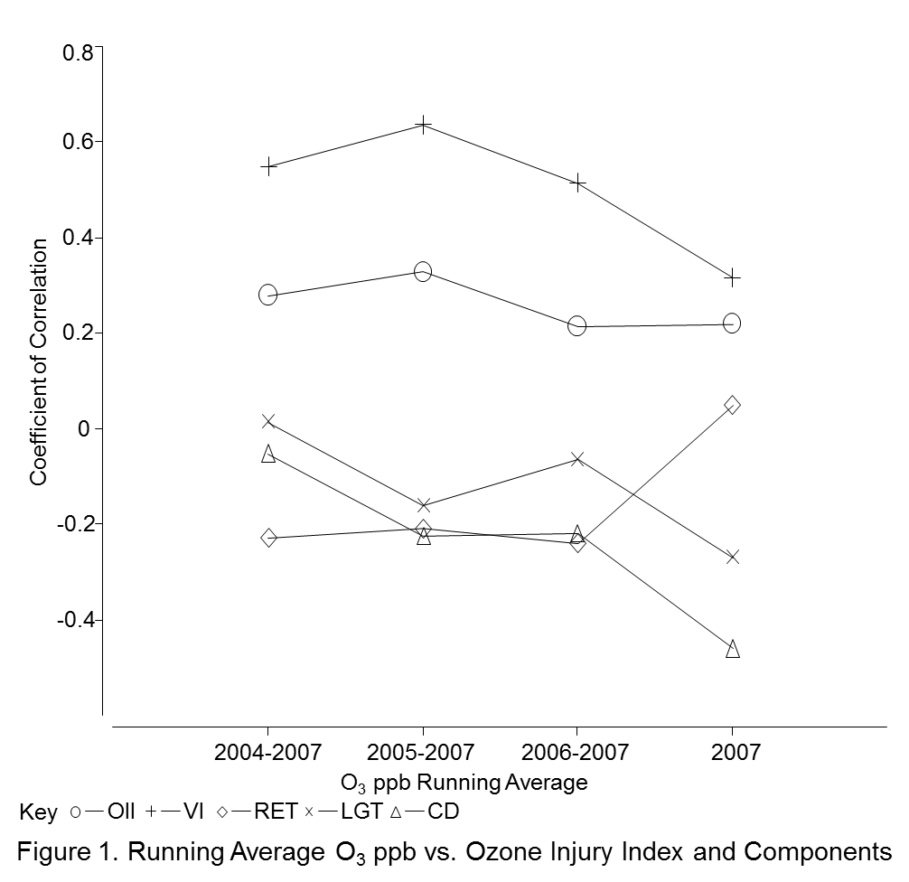
If we want to try and monitor air pollution levels in remote mountain sites cost-effectively, we can use in situ bioindicator species, but first we must understand the environmental and physiological mechanisms that lead to ozone injury to our target bioindicator species. Plant physiology helps us understand ozone injury as a cumulative exposure process, especially on evergreen conifer species.
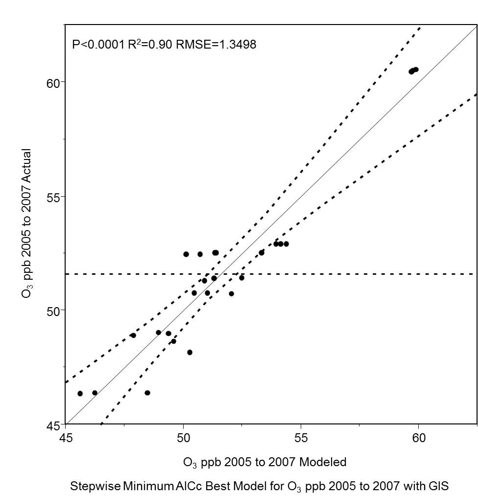
GIS models can help us understand the air pollution spatial dynamics and estimate how plant water availability affects stomatal conductance and ozone stomatal uptake.
 Putting this knowledge together with GIS analyses of environmental conditions that affect plant water relations (and thus stomatal conductance and uptake), allows us to build a working model using simple field measurements and spatial analyses to measure cumulate ozone pollution in remote areas using bioindicator species.