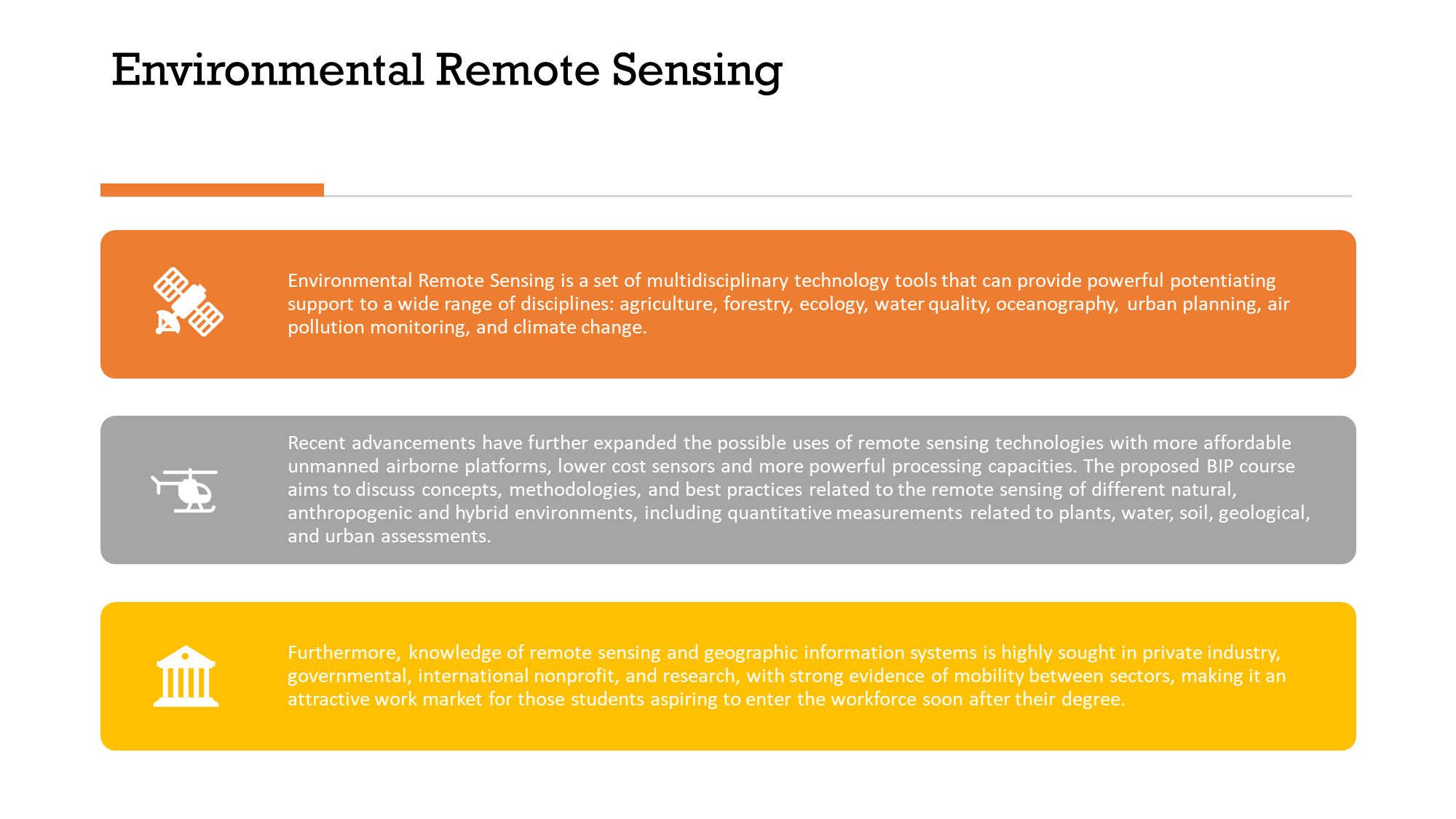
Environmental Remote Sensing Erasmus+ BIP

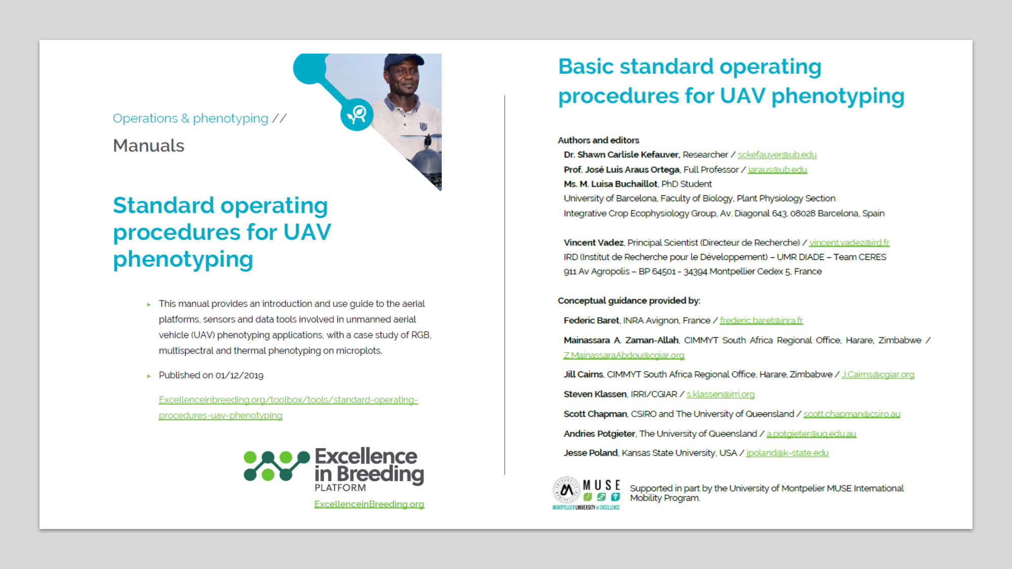


Plant Ecophysiologist, University of Barcelona
Environmental Remote Sensing Erasmus+ BIP


http://www.inia.gob.pe/sala-de-prensa/notas-de-prensa/1672-2016-nota-n223
(Lima, 01 de agosto de 2016).- El Instituto Nacional de Innovación Agraria (INIA), realizó el Primer Curso Internacional de Agricultura de Precisión, con la participación de más de 60 profesionales, productores y estudiantes universitarios a nivel nacional.
Alberto Maurer Fossa, jefe del INIA, señaló que la capacitación busca transferir conocimientos tecnológicos con la finalidad de que el productor agrario incremente su productividad y reduzca costos de producción.
También indicó que este método permite identificar a profundidad las plagas y enfermedades que aquejan a los cultivos, requerimiento de fertilizantes, agua, entre otros, para tomar medidas correctivas y obtener buenos resultados en el campo.
Por su parte, Benjamín Quijandría Salmón, director de Desarrollo Tecnológico Agrario, manifestó que el INIA viene contribuyendo con el desarrollo de la agricultura peruana, mediante técnicas que aseguran elincremento de la competitividad de la familia campesina.
El evento consideró el intercambio de información sobre el tema en países como España, Colombia y Chile.
Luis Narro León, especialista del Centro Internacional de Mejoramiento de Maíz y Trigo (CIMMYT) de Colombia, indicó que “el cultivo de maíz es uno de los más importantes en el mundo por su extensa área cultivada, así como su aporte a la alimentación humana y animal”, a través de su ponencia importancia del genotipo y del medio ambiente en la producción del maíz amarillo duro.
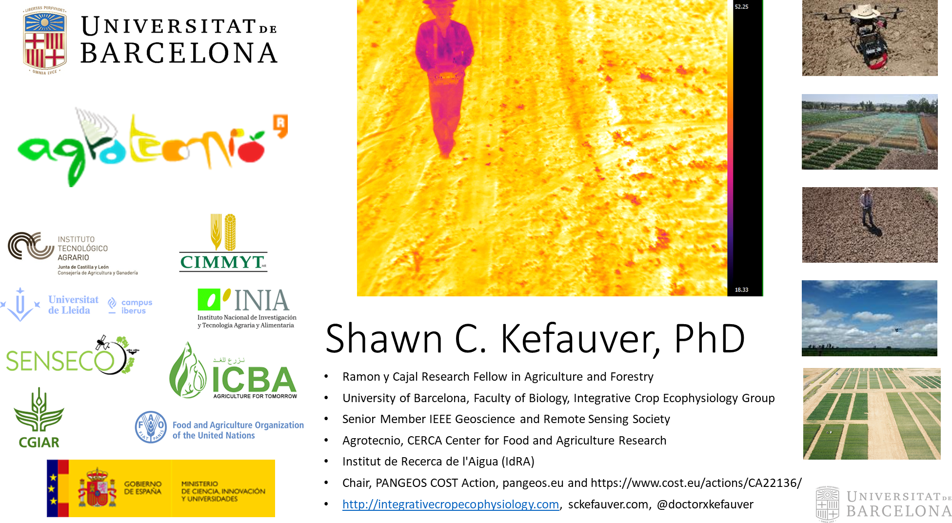
Participaron del evento el representante de la Universidad de Barcelona España, Shawn Carlisle Kefauver; Gustavo Lobos Prats, de la Universidad de Talca en Chile; Daniel Díaz Atacuri, del Instituto Nacional de Investigación y Capacitación de Telecomunicaciones (INICTEL), entre otros profesionales destacados.
PROGRAMA
18 de julio 2016
|
HORA |
TEMAS A DESARROLLARSE |
PONENTE |
| 8:00 a 9:00 |
|
|
|
9:00 a 9:30 |
Bienvenida a los participantes.
Inauguración del curso Dr. Alberto Maurer Fossa Jefe del INIA |
|
|
9:30 a 10:00 |
Los aportes tecnológicos del INIA al desarrollo de la agricultura peruana | PhD. Pablo Benjamín Quijandría Salmón
Director General Dirección de Desarrollo Tecnológico Agrario |
|
10:00 a 11:00
|
Importancia del Genotipo y del Medio Ambiente en la producción del Maíz Amarillo Duro. | PhD. Luis Narro León
CIMMYT, Colombia. |
| 11.00 -12:00 | El uso de la teledetección en sus diferentes ámbitos: tipos de técnicas, y su aplicación en la agricultura actual | PhD. José Luis Araus
Universidad de Barcelona, España |
| 12:00 a 12:15 |
BREAK |
|
|
12:15 a 13:15 |
Teledetección Ambiental. | PhD. José Luis Araus
Universidad de Barcelona, España |
| 13:15 a 14:00 |
ALMUERZO |
|
|
14:00 a 14:45 |
Plataforma de alto rendimiento para evaluar el estado fisiológico de las plantas de manera extensiva, rápida y a gran escala |
PhD. José Luis Araus
Universidad de Barcelona, España |
|
14:45 a 16:15 |
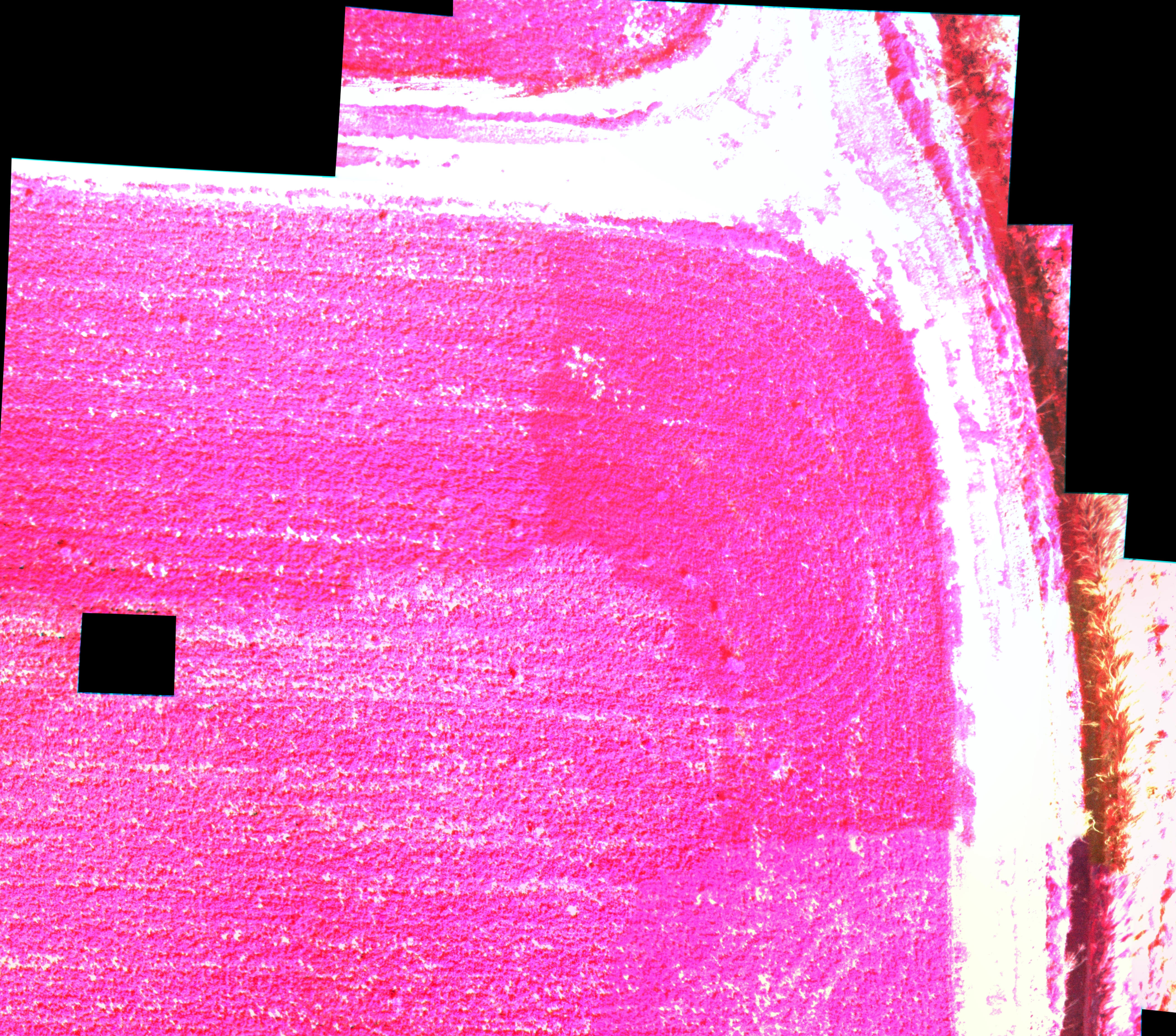
Uso de drones y construcción de mosaicos y modelos 3D
Análisis de Imágenes RGB, multiespectrales y térmicas |
PhD. Shawn Carlisle Kefauver
Universidad de Barcelona- España |
|
16:15 a 17.00 |
El sistema de Riego Computarizado y uso de sensores remotos en el cultivo de frejol
|
PhD. Erich SaeetoneUniversidad de Lima – Perú |
19 de julio 2016
|
HORA |
TEMAS A DESARROLLARSE |
PONENTE |
| 8:00 a 10:15 |
Orto- Rectificación de imágenes aéreas obtenidas con el dron y modelos 3D de plantas enteras con Visual SFM
|
PhD. Shawn Carlisle Kefauver
Universidad de Barcelona, España |
| 10:15 a 10:30 |
BREAK |
|
| 10.30- 12:15 |
Elaboración de resultados obtenidos con las imágenes RGB y aprendizaje del Programa FIJI.
|
PhD. Shawn Carlisle Kefauver
Universidad de Barcelona, España |
|
12:15- 13:30 |
Obtención y Análisis de imágenes satelitales mediante QGIS |
PhD. Shawn Carlisle Kefauver Universidad de Barcelona, España |
|
13:30 a 14.15 |
ALMUERZO |
|
|
14:15 a 16:00 |
Continuación de la elaboración de resultados con gráficos en QGIS y estadística en R. |
PhD. Shawn Carlisle Kefauver
Universidad de Barcelona, España |
|
16:00 a 17.00 |
Empleo de isótopos estables y otras técnicas analíticas de laboratorio en el fenotipado y estudios de agronomía. |
PhD. María Dolors Serret
Universidad de Barcelona, España |
20 de julio 2016
| Mañana | ||
| 8:30 – 9:30 | Detección del Estrés Hídrico por Medio del Uso de Imágenes Térmicas Aéreas y terrestres. Estudio de caso de vides y olivos. | Carlos Alberto Poblete Echevarría PhD.
Pontifica Universidad Católica de Valparaíso – Chile |
| 9:30 -10:30 | Uso de software para realizar análisis de reflectancia espectral (Spectral Knowledge). | Gustavo Lobos Prats PhD
Universidad de Talca, Chile |
| 10:30-10:45 | Break | |
| 10:45 -11:45 | Predicción de variables fisiológicas en mejoramiento de trigo y arándanos y presentación de la Red Latinoamericana en Fenomica y mejoramiento de plantas | Gustavo Lobos Prats PhD
Universidad de Talca, Chile |
| 11:45- 12:45 | Aplicación de la Ingeniería Aeroespacial Geomática y geo información en la agricultura de Precisión | Dr. Víctor Hugo Roggero
Coordinador Académico de las Universidades Alemanas de Stuttgart y München |
| Almuerzo | ||
| 2:30-3:15 | El Uso de los TICs en la Transferencia de Tecnología en la Agricultura de Precisión | Ing. MSc. Pedro Injante/ Dr. Daniel Diaz Atacuri
INIA – INICTEL – UNI Perú |
| 3:15 -4:00 | Uso Eficiente del Nitrógeno en Maíz Usando Tecnologías de Sensores Remotos “Una Necesidad Apremiante” | Ing. MSc. Argemiro Moreno Berrocal.
CIAT – CENIFICAFE Investigador Científico II Colombia |
| 4:00 – 4:45 | Uso de las cámaras Hipe espectrales en la obtención de firmas espectrales. (Practica)
Presentación de drones con fines agrícolas (practica) Presentación de carro Robot con sensores que detectan gases en la minería
|
Ing. MSc. Joel Tello
INICTEL – Universidad de Ingeniería – Perú |
| 4:450 – 5:15 | Clausura del Evento/entrega de certificados | Pablo Benjamín Quijandría Salmón PhD.
Director General de la Dirección de Desarrollo Tecnológico Agrario – INIA |
They can’t seem to get enough of me!
This time I was working in collaboration with the “Advanced Course USE OF SENSORS IN PRECISION AGRICULTURE Zaragoza (Spain), 7-12 March 2016” of the Mediterranean Agronomic Institute of Zaragoza (IAMZ) of the International Centre for Advanced Mediterranean Agronomic Studies (CIHEAM) with a short statement and a dron flight from minute 28:30 to 32:00.
The direct link is here.
Note that I am at the University of Barcelona now. (though I was previously at the UAB)
Here some more detail about the course:
Precision agriculture (PA) is the management of spatial and temporal variability to improve economic returns and reduce environmental impact. PA technology makes it possible to log data of soil and crop properties at even centimetre level across an entire field. Although most people can see the benefits of using a more precise approach to manage crops with additional information, the tools provided by PA and other information technologies have not yet moved into mainstream agricultural management. The complexity and the investment in new equipment inhibit easy adoption. Training in the use of tools and technologies and a deeper analysis of successful implementation can enhance adoption. Sensors play a crucial role in PA. They are the key for collecting data in a more efficient way in order to make the most appropriate management decisions. The objective of the course is to deliver knowledge about different aspects of sensors, how to use them and how to integrate their data into the decision making process. The focus will be on the specificities of the Mediterranean agriculture.
The course will take place at the Mediterranean Agronomic Institute of Zaragoza (IAMZ) of the International Centre for Advanced Mediterranean Agronomic Studies (CIHEAM), and will be given by well qualified lecturers from research centres and universities in different countries.


Finally got my website updated at the University of Barcelona, in three languages nonetheless!
http://www.ub.edu/bioveg/fisioveg/eng/Shawn_Carlisle_Kefauver.htm
Shawn Carlisle Kefauver
 |
| DATA | |
| Name: | Shawn Carlisle Kefauver |
| Associate Professor Ph.D. in Ecology, 2013 |
|
| E-mail: | sckefauver@ub.edu |
| Telephone: | +34 620 738 590 |
| Research: | Airborne science applications, environmental remote sensing, geographic information systems for plant eco-physiology, air pollution and climate change in agriculture and natural environments in the Mediterranean. |
Research interests:
Dr. Kefauver’s current research and teaching interests are plant eco-physiology, climate change, and plant stress applied to Mediterranean crops and natural environments, including thermal remote sensing, imaging spectroscopy and GIS applications for multi-scale scientific research on these topics.
Current research projects:
Spanish National Projects:
“Fenotipeado de precision a gran escala en trigo duro: bases fisiologicas y herramientas de selección.” Investigador Principal José Luís Araus Ortega. (Universitat de Barcelona). 01/09/2014-01/09/2017.
International Projects:
“HTPPs and open-source image processing tools for maize foliar disease assessments.” International Maize and Wheat Improvement Center (CIMMYT). Principal Investigator Shawn Carlisle Kefauver. (University of Barcelona). 1/01/2015-31/12/2016.
| Recent publications: |
| Kefauver SC, El-Haddad G, Vergara-Diaz O, Araus JL, editors. RGB picture vegetation indexes for High-Throughput Phenotyping Platforms (HTPPs) 2015: International Society for Optics and Photonics. |
| Vergara-Diaz O, Kefauver SC, Elazab A, Nieto-Taladriz MT, Araus JL. Grain yield losses in yellow-rusted durum wheat estimated using digital and conventional parameters under field conditions. The Crop Journal. 2015. |
| Salerno JD, Mulder MB, Kefauver SC. Human migration, protected areas, and conservation outreach in Tanzania. Conservation biology. 2014;28(3):841-50. |
| Moreno-Ruiz JA, Garcia-Lazaro JR, Riano D, Kefauver SC. The Synergy of the 0.05^ circ (sim5nbsphbox {km}) AVHRR Long-Term Data Record (LTDR) and Landsat TM Archive to Map Large Fires in the North American Boreal Region From 1984 to 1998. Selected Topics in Applied Earth Observations and Remote Sensing. 2014;7(4):1157-66. |
| Kefauver SC, Penuelas J, Ribas A, Díaz-de-Quijano M, Ustin S. Using Pinus uncinata to monitor tropospheric ozone in the Pyrenees. Ecological Indicators. 2014;36:262-71. |
| Kefauver SC, Filella I, Peñuelas J. Remote sensing of atmospheric biogenic volatile organic compounds (BVOCs) via satellite-based formaldehyde vertical column assessments. International Journal of Remote Sensing. 2014;35(21):7519-42. |
| Kefauver SC, Peñuelas J, Ustin S. Using topographic and remotely sensed variables to assess ozone injury to conifers in the Sierra Nevada (USA) and Catalonia (Spain). Remote Sensing of Environment. 2013;139:138-48. |
| Kefauver SC, Peñuelas J, Ustin SL. Improving assessments of tropospheric ozone injury to Mediterranean montane conifer forests in California (USA) and Catalonia (Spain) with GIS models related to plant water relations. Atmospheric Environment. 2012;62:41-9. |
| Kefauver SC. Remote Sensing of Bioindicators for Forest Health Assessment. 2012. |
| Kefauver SC, Peñuelas J, Ustin SL, editors. Applications of hyperspectral remote sensing and GIS for assessing forest health and air pollution2012 2012: IEEE. |
| Kefauver SC, Ustin S, Davey SW, Furey BJ, Gartner A, Kurzweil D, et al. The NASA/NSERC Student Airborne Research Program Land Focus Group-a Paid Training Program in Multi-Disciplinary STEM Research for Terrestrial Remote Sensing. AGU Fall Meeting Abstracts. 2011;1:0541. |
| Furey BJ, Kefauver SC. Comparing SEBAL and METRIC: Evapotranspiration Models Applied to Paramount Farms Almond Orchards. AGU Fall Meeting Abstracts. 2011;1:0220. |
| Ustin SL, Valko PG, Kefauver SC, Santos MJ, Zimpfer JF, Smith SD. Remote sensing of biological soil crust under simulated climate change manipulations in the Mojave Desert. Remote Sensing of Environment. 2009;113(2):317-28. |
| Roy S, Ustin S, Kefauver SC. Estimation of Evapotranspiration of Almond orchards using Remote Sensing based SEBAL model in Central Valley, California. AGU Fall Meeting Abstracts. 2009;1:0822. |
| Ustin SL, Andrews M, Andrew ME, Cheng Y-B, DiPietro D, Kefauver J, et al. Application of hyperspectral techniques to monitoring and management of invasive plant species infestation. DTIC Document, 2008. |
| Kefauver SC. Assessing Tropospheric Ozone Impacts on Bio-indicator Species Using Imaging Spectroscopy and GIS in Yosemite and Sequoia/King’s Canyon National Parks. 2008. |
| Greenberg JA, Smith A, Ho J, Dobrowski SZ, Kefauver S, Vanderbilt V, et al. A Comparison Of Tree Crown Recognition Techniques. AGU Fall Meeting Abstracts. 2007;1:1445. |
| Underwood EC, Mulitsch MJ, Greenberg JA, Whiting ML, Ustin SL, Kefauver SC. Mapping invasive aquatic vegetation in the Sacramento-San Joaquin Delta using hyperspectral imagery. Environmental Monitoring and Assessment. 2006;121(1-3):47-64. |
My first co-authored publication at my new research group at the University of Barcelona. Great work, Omar!
Free download link good for 50 days: http://authors.elsevier.com/a/1RBIU7tXQ-BBWZ
As of October 2014, I have taken up a new position as a Postdoctoral researcher at the University of Barcelona in the Plant Physiology Unit of the Plant Biology Department! Here is my new lab website: http://www.ub.edu/bioveg/fisioveg/eng/index.htm
My research will now be with Professor Josep Lluis Araus on the development of drone-based multispectral, thermal, and RGB airborne sensor technologies for agricultural research, with a specific focus on phenotyping wheat, maize and other crops for improved yield and resilience to climate change.
The position also includes a lecturing requirement in applied plant physiology, which I will teach in a combination of Catalan and English.
In the first few months since I joined the UB, I have also been funded as the principal investigator on the CIMMYT-funded research project “HTPPs and open-source image processing tools for maize foliar disease assessments” in collaboration with the Kenyan Agricultural Research Institute.
A PhD student in the group and I have also been awarded an award from the Goetz Instrument Program from PANanalytical and ASDi, which includes the use of a ASD Field Spec Pro, including shipping and presentation expenses, for our upcoming wheat phenotyping research this coming summer!
(http://www.asdi.com/service-and-support/goetz-instrument-support-program)

La feina de l’Agència Espacial nord-americana és sempre espectacular però no tant llunyana com sembla. De fet, la seva tecnologia també s’usa a casa nostra, entre d’altres coses, per examinar la qualitat de l’aire que respirem i la dels boscos catalans. SHAWN KEFAUVER, un biòleg i investigador de Texas fincat a Catalunya, ens parla dels seus treballs en salut forestal al Centre de Recerca Ecològica i Aplicacions Forestals (CREAF) a la Universitat Autònoma de Barcelona (Foto: http://blog.creaf.cat)
http://rac1.org/totespossible/blog/els-boscos-catalans-amb-ciencia-de-la-nasa/

I have always taken the initiative towards accomplishing my own specific life goals and career objectives. Earlier in my educational career, I eagerly sought out more experience in international and current research and made the extra additional effort to apply for and attend three study abroad programs and completed the necessary requirements to get all of my coursework abroad approved for my university degree so that I could still graduate in a timely manner. Immediately after my university degree, I took a summer program management position not as a researcher, but rather as the program coordinator based on my experience in event management and group leadership from previous work on campus as an undergraduate. To move into a scientific career as I desired, I decided to actively pursue a volunteer scientific research internship in Ecuador working as both a field assistant and Spanish language translator, taking advantage my experiences from studying abroad to acquire the competitive internship position. This work resulted in my first scientific publication and has been cited in numerous conservation and indigenous rights efforts in Ecuador since.
This internship landed me a position as a lab manager at a major research laboratory, the Center for Spatial Technologies and Remote Sensing, and location of one of the top graduate programs in Ecology in the nation, the University of California at Davis. As a laboratory manager for two years at Dr. Susan Ustin’s Center for Spatial Technologies and Remote Sensing at the University of California, Davis, I benefited from involvement in nearly every project of a major research laboratory and quickly learned the field and remote sensing preprocessing techniques required for the successful calibration and correction of airborne and satellite imagery. In New Mexico, working with the Los Alamos National Laboratories, I used field spectroscopy to identify the water potential thresholds that lead to drought stress-induced ecotone shifts. In the California central valley I worked on precision agriculture in cotton fields, looking to improve irrigation and develop techniques for variable rate nitrogen application using aerial photography and thermal remote sensing. As part of the Strategic Environmental Research and Development Program (SERDP) funded by the US Department of Defense, I helped develop hyperspectral remote sensing techniques for mapping invasive weeds species on US Military bases in several different states across the United States. As part of the same project we held workshops to teach government employees how to apply everything that we had learned in the process. It was awarded best project of the year by the United States Department of Defense.
After two years working at the Center for Spatial Technologies and Remote Sensing at the University of California at Davis, and participating on a wide range of research projects described in more detail previously and noted in my publication and presentation record, I decided to continue my university education with a postgraduate Masters in Ecology. One project in particular interested me more than the others because of the complexity of the problem and the importance of a detailed understanding of the issue. The project focused on assessing and predicting damage to forest health in national parks by pollution (primarily high levels of ozone) coming from the developed coastal and central valley regions of California. In my investigations on the vectors of change, automobile traffic and industrial pollution coming from the coastal developments of California, the issues surrounding transboundary air pollution came to my attention. The seriousness of the ecological impacts of harmful pollution levels needed be presented such that people understand how it is a combination of complex interactions that make this ecosystem fragile and susceptible to their actions.
Before completing my Masters I was awarded a Fulbright Student Fellowship to Barcelona, Spain to conduct similar research at the CREAF lab with Dr. Josep Peñuelas, whom I had contacted after reading extensively about his research. There, in collaboration with Dr. Josep Peñuelas of the Autonomous University of Barcelona, I added an additional robust suite of remote sensing, climate and air pollution data to ongoing biomonitoring research efforts. Through a special international scientific research and development agreement with the Cartographic Institute of Catalonia, CASI data was collected along with needle samples for analyses of foliar water content, photosynthetic pigment concentrations and OII visual assessments of ozone-induced damage. Classification maps were completed to focus on target bioindicator species and then imaging spectroscopy analyses of their health status were compared with extensive field assessments of air pollution impact. GIS analyses which approximate watershed-level relative hydrologic status were combined in multivariate analyses to investigate the relationships between natural landscape gradients and the impacts of ambient tropospheric ozone levels. So, although I started a Masters program in 2004, I took a break for a Student Fulbright to Spain in 2006-7, which eventually led to a long-term collaboration and my PhD dissertation work, officially finishing my Masters in 2008 and my PhD in 2012.
I have always also been interested in teaching and outreach as shown by enrolling in teaching workshops at UC Davis, took Teaching Assistant positions and joined outreach initiatives with UC Davis extension and public environmental management agencies whenever possible throughout my graduate career. I attended a certificate-bearing teaching philosophy enrichment lunchtime course to improve my capacity to connect with students. I intentionally doubled the required minimum of Teaching Assistantships which through proactive measures. At the start of my PhD, I acquired a paid internship was offered working with the Santa Clara Valley Water District (public conservation and management group near Davis, CA) on the development and agency instruction of cost effective techniques for mapping agricultural lands using remote sensing technology. I coordinated the collection of field training data and arranged for the tasking, download of satellite imagery from my home office through careful instruction. As a final product, I produced a 100 page manual for remote sensing of agricultural lands using ERDAS software and both freely downloadable and purchasable satellite data and presented my findings in a three hours final seminar. One year later, when an opportunity arose to work with outreach, video and graphics specialists with the University of California at Davis Extension Office on the development of on online Remote Sensing and GIS course, I immediately seized the opportunity. For six months I worked three days a week, while still taking graduate courses, on the scientific advising of this multidisciplinary team for the development of the CalView program.
My leadership and teaching skills synergized wonderfully when I was given the opportunity by UC to become a Mentor for the NASA-NSERC Student Airborne Research Program. Now after three highly successful years (2009-2011) as a Mentor in the program, the SARP program is attracting national news and top officials from NASA Earth Science and Education directorates and has inspired a new generation of young scientists to go in the field of earth systems science research. For three summers, I have worked as a Mentor for the Student Airborne Research Program (SARP) of the National Suborbital Education and Research Center (NSERC), which is funded by the National Aeronautics and Space Administration (NASA) teaching the estimation of evapotranspiration for almond and pistachio orchards in the central valley of California. The NASA/NSERC SARP program is a unique six week multidisciplinary paid training program which directly integrates students into the forefront of airborne remote sensing science, and benefits from access to the DC-8 airborne platform and the MODIS-ASTER Airborne Simulator (MASTER) sensor. As Mentor, I have guided students for three summers through every aspect of combining imaging spectroscopy and thermal remote sensing from classroom lectures, software training, field and imagery calibration data collection, imagery calibration and pre-processing, proposal development, analysis, and presentations. Final project results include comparisons of multivariate analyses of plant health and structural measurements, imagery atmospheric and geometric corrections, and estimates of evapotranspiration using various models.

